Travel | CaliforniaNotes 2

©2020 by Vernon Miles Kerr, VernonMilesKerr.com, WritersClass.net
October 30, 2020
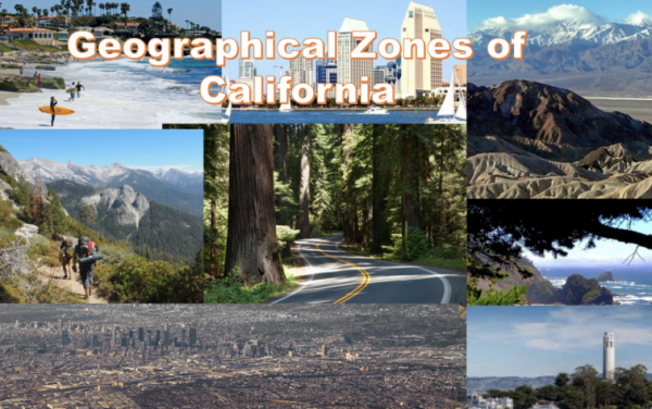
In my previous post, Travel | CaliforniaNotes I likened Texas and California as both being countries-within-a-country. Actually, California is more like a continent-within-a-(former)country. From semi-tropical San Diego and Los Angeles, to the Scotland-like, extreme North Coast, with its cold, blowing rain, near Crescent City —
from the eerily New England feel of the Sierra Gold country, The Mother Lode, to the volcanos of the Southern Cascade range, near the Oregon border, Shasta and Lassen —
from one of the world’s hottest, driest and lowest deserts, Death Valley, to (only 66 miles away) the Matterhorn-like highest peak in the coterminous United States, 14,505 foot Mount Whitney — California has zones that incorporate features of nearly all of North America — including minor Sierra glaciers.

In my last post, I advocated driving an automobile or RV through California. Yes, one can hop around from one major tourist site to another by air, collecting virtual travel-badges and still go home satisfied. But that’s the typical California vacation — and not nearly as satisfying as having experienced the width, depth and breadth of California at ground level. How else could one experience the vast, stifling, tedious distance over that desert-path through the Mohave that the 1930s Dust Bowl refuges endured? Even skimming along at near 80 mph in a modern air-conditioned car, between Needles and Tehachapi, you wonder if you’ll ever get to the Coast. Suddenly you have a new appreciation for what it must have been like chugging along at 35 or 45 mph with hot desert air, and the splatter from a boiling radiator, pelting your face. And what was it like for 19th Century pioneers, riding in covered-wagons pulled by mules or oxen? No such understanding is possible from 30,000 feet.
But choosing a driving-itinerary from the thousands of possible routes through the Golden State’s surfeit of highways and byways can be daunting. In future posts I’ll propose some alternate routes which take in nearly all of California’s geographical zones. Each itinerary will hit some of the high-points, some of the history, and lots of the ground-level “tedium” in between.
VMK
