Travels | U.S. Interstate 70

While it seems I’ve lived my “civilian” life migrating up and down California’s Highway 99, my gig-worker, tech-life is different. It has been unfurled along U.S. Interstate70.
I’ve recently called California 99 (formerly U.S. 99) “California’s Main Street,” and using a similar metaphor, we can accurately say that U.S.. Interstate 70, hereinafter “70,” is “America’s Waistband.” Ironically, 70 begins and ends rather unceremoniously. It runs from a “Park-N-Ride” lot, in the virtual backyard of the Social Security Administration campus in Baltimore, across Pennsylvania’s Amish Country, over the Ohio River at Wheeling, West Virginia, and down onto America’s Great Plains — piercing through Columbus, Indianapolis, 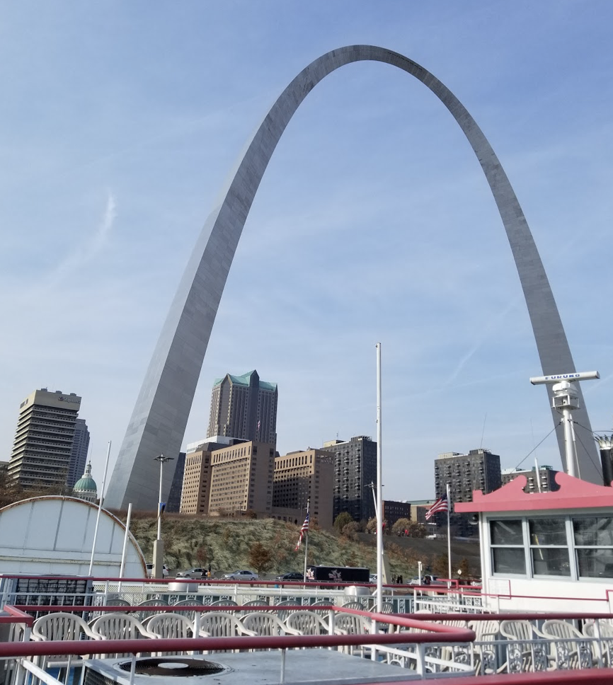
St. Louis, Kansas City, Denver, Grand Junction and Utah’s Wasatch Range until making a “T”with Interstate 15, about half-way between Las Vegas and Salt Lake City. If you’re thinking “that was one helluva run-on sentence,” well, 70 is one helluva great, long, tour, across America’s mid-section.
My earliest introduction to 70 was in 1978. I was a salesman for a computer service bureau. Our company had mainframes in Canton, OH, Atlanta, GA and Santa Ana, CA. The service we offered was retrieving data from the first electronic cash registers equipped with modems. The data could then be processed into printed sales reports, and be FedEx’ed, the very next morning, to the retailers’ headquarters.
My territory was the Western U.S. — I believe it was from the Mississippi River to the West Coast, but the details escape me. I had to spend a lot of time on airplanes. I remember that part. I also remember that I had a young, enthusiastic Mormon guy, a seller of those modem-equipped electronic cash registers (ECRs) who kept calling me from Grand Junction, Colorado.
“I’ve got a ton of stuff going on with retailers all across the Western Slope. It would really help if you could fly over and go visit some of them with me. Tell ’em about the backend, the reports by FedEx, all that.” He eventually wore me down. Soon I was touching down at the little regional airport in Grand Junction.
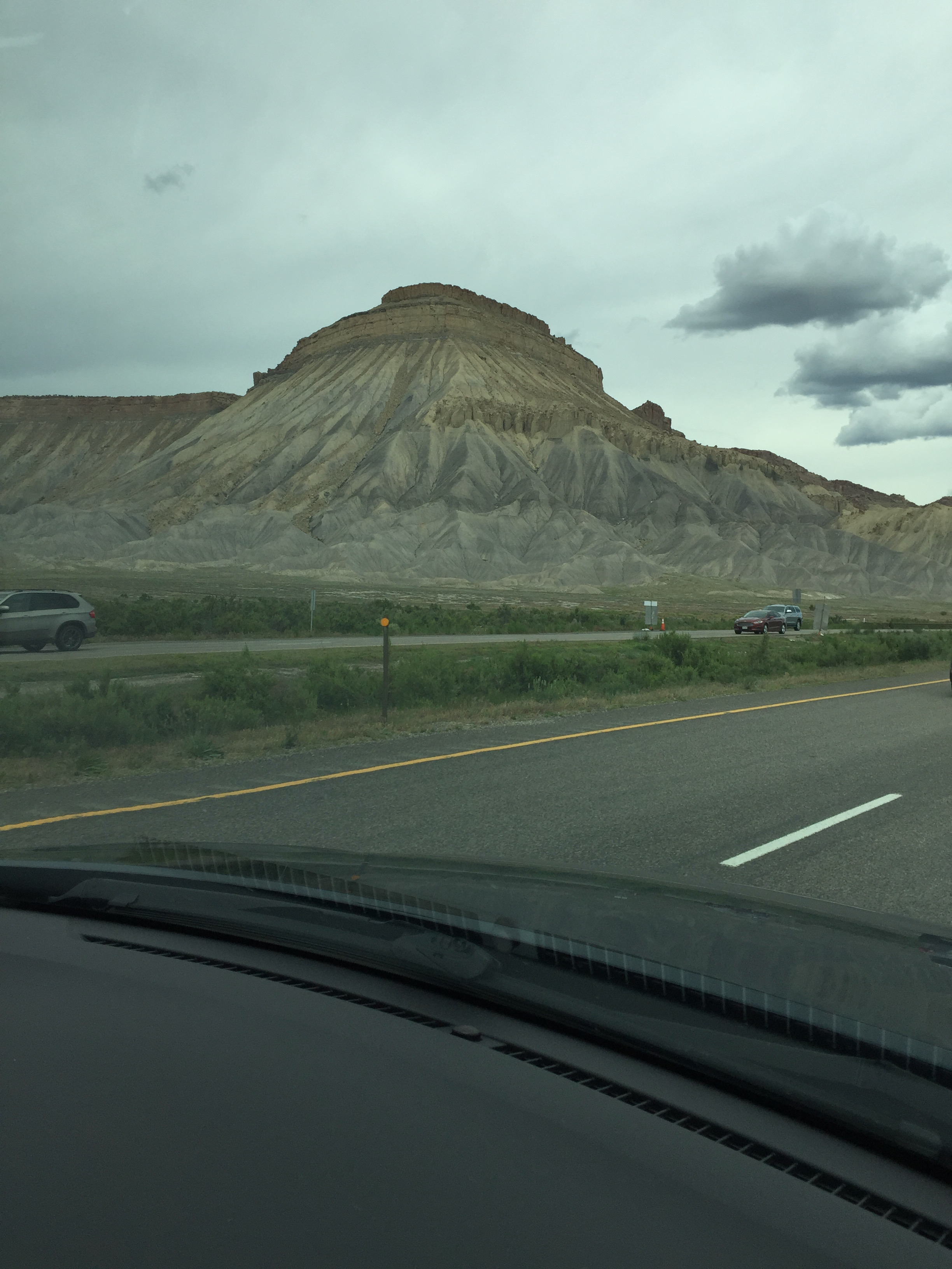
Standing at the foot of the plane’s staircase, I was immediately awed. Looming over the green valley to the East was a long, dry mesa, terminated by a gibraltar-like monolith — like some dry-land version of Diamomd Head.
My guy there, Steve, said, “That’s the Grand Mesa and Mount Garfield. We’ll be driving by there tomorrow on our way up to Glenwood Springs.”
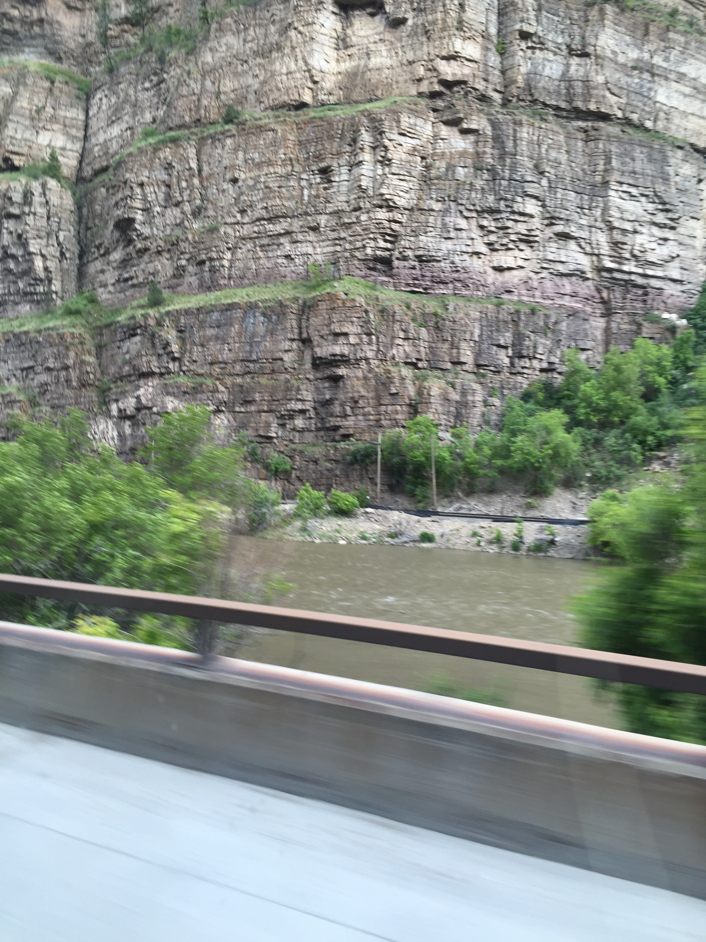
The next morning we accelerated out onto 70 headed East, toward Glenwood Springs, past the peach orchards of Palisade, past Mount Garfield, and up the twisty De Beque Canyon through little towns, like Eagle and Rifle — with the churning water of the upper Colorado River, competing with Interstate 70 for space between looming canyon walls.
As we started up the grade toward Palisade, Steve had said, “In back of us, there across the Valley is the Colorado National Monument. It’s huge and like a moonscape. It stretches to the Utah border. We camp up in the ‘Monument’ a lot in the summer.”
Behind that — beyond the Monument, toward the West — was the part of 70 that winds toward its terminus at Interstate 15 — the part I would drive a few times myself, headed both East and West, two and three decades later.
I would first drive it in 2008, headed for a gig in Boulder with my wife as navigator. We had just dropped off our son and brand-new daughter-in-law in Las Vegas, so that they could continue their honeymoon —while we proceeded East.
Our normal “safe route” had previously been up through Salt Lake City and then across on Interstate 80 to Cheyene WY. But it was summer, and the weather over the Rockies was predicted to be calm. So we decided to turn right at I-70 and shoot straight across to Denver.
Right away, we were glad we did. Moving East along Interstate 70, from its origin at the Interstate 15 Junction, it doesn’t take long for you to realize you are at the bottom of the Northern reaches of the Grand Canyon.
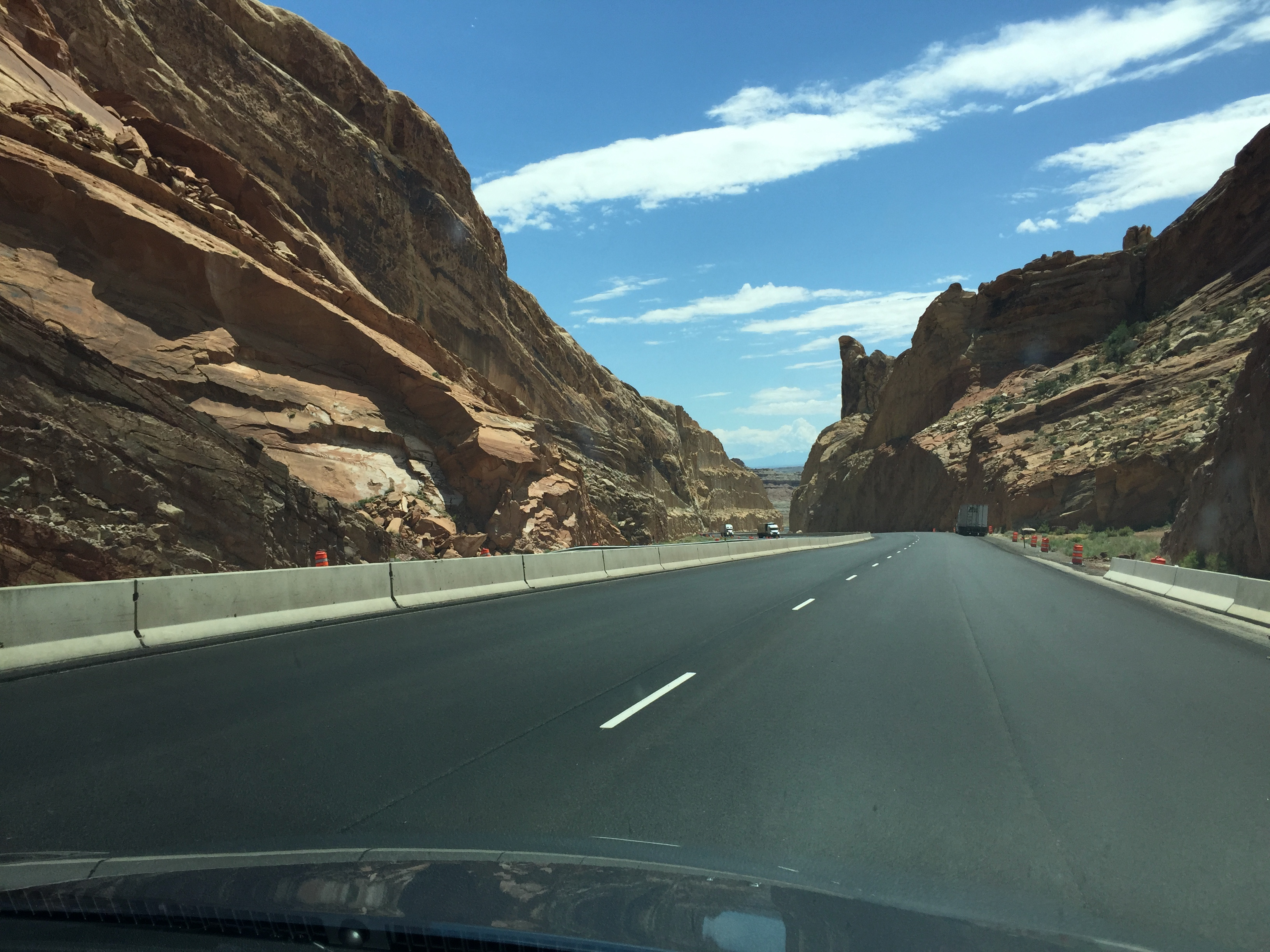
It’s wider and the canyon walls are not as deep, but — what a way to run the Colorado! (Zipping along at near 80 mph on some gorgeous, 4-lane pavement — banking, rising, dipping, as if you’re in an airplane. And, all upstream, agains the current of the Colorado at that,.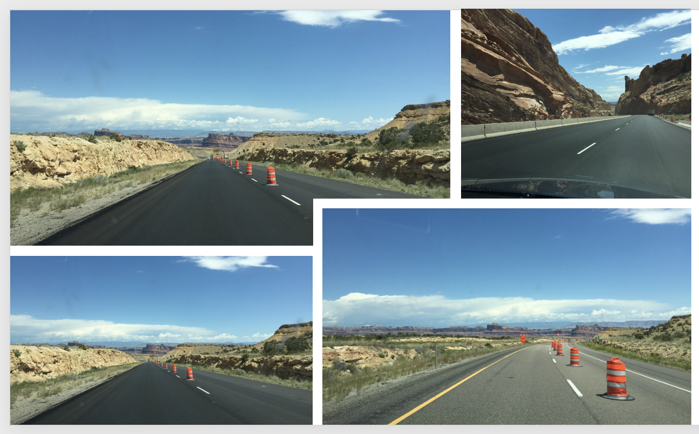
The path across the Wasatch range, across Eastern Utah and alongside the Colorado National Monument is spectacularly punctuated by torturous rock formations. One long section has the towering “Book Cliffs,” which do indeed resemble a gigantic bookshelf of 200 or 300 foot-high tomes, diminishing into infinity in the distance ahead.
It was great seeing Grand Junction again after 30 years. We buzzed through the valley with only one stop, though — at a McDonalds in Fruita, for lunch. As we began moving up the slope past Palisade, the peach orchards of 1978 had been replaced by grape vineyards. There are several wineries in Grand Junction now. I was amazed. Wineries in Colorado. But then I remember my associate Steve calling the Valley a “banana-belt.” I was a bit incredulous at the time: the nighttime temperatures were well below freezing. I guess “GJ’ (his term for Grand Junction) is indeed a banana-belt compared to Denver, over on the Front Range, on the Eastern side of the Rockies.
But returning to 2008, Denver is where we were headed. Well actually, Boulder, a nearby suburb. The trip across the Rockies was uneventful, weatherwise. We stopped in Glenwood Springs, went to Starbucks for our favorite, a “Flat-White.” Glenwood had grown — a lot. There, the Colorado is a churning white water rapid, and beyond Glenwood the canyon narrows to where one direction of travel must be elevated.
Not long thereafter, 70 took us by the famous ski-villages of Vail and Beaver Creek, both at more than 11,000 feet in elevation. Beyond there, with the Colorado River still on the right and flowing toward the West, we entered the Eastbound bore of the long Eisenhower Tunnel. Halfway through the bore, deep under the mountain, is a sign reading “Continental Divide.” Exiting the tunnel, there was still a river — actually, Clear Creek – on our right, but it was flowing toward the East. This was a graphic lesson in the meaning of the term “Continental Divide.” While the Colorado eventually empties into the Gulf of California, Clear Creek, after stopping off at the Coors Brewery in Golden, makes its way to the Gulf of Mexico.
From the mouth of the Eisenhower Tunnel, it was all downhill, and soon the Denver megalopolis, with its population of nearly three million, was spread out below. VMK
In a future installment of “Interstate 70” I’ll describe a Westward trip on 70, starting from that “Park-n-Ride” lot in Baltimore.
